Want insights on your city’s infrastructure? Now you can Google it.
AI Article Summary
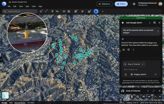
Google has introduced a new feature in Google Earth called 'Ask Google Earth' that allows users to access detailed information about city infrastructure. This tool provides visibility into elements such as stop signs and storm drains. It aims to enhance public understanding and engagement with city planning and development. Such access to infrastructure data can empower residents and professionals alike.
What This Means for Canadian Contractors
This project shows how digital tools can provide unprecedented access to public infrastructure data, potentially streamlining planning processes. For Canadian builders, this means improved planning capability and more data-driven decisions, possibly reducing project timelines and permitting inefficiencies. It may also influence discussions around urban development and infrastructure investment.