First high-resolution 3D map covering all of Earth’s 2.75 billion buildings unveiled
AI Article Summary
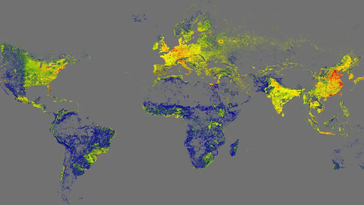
Scientists at the Technical University of Munich have created the GlobalBuildingAtlas, a high-resolution 3D map depicting all of Earth's 2.75 billion buildings. This digital representation provides a critical tool for climate research and urban planning, offering detailed insights into infrastructure and social-economic conditions worldwide. The new dataset reveals not just the footprint but also the volume of buildings, enhancing precision in urbanization analysis and disaster management.
What This Means for Canadian Contractors
This project shows how high-resolution mapping can significantly improve urban planning and disaster preparedness, setting a benchmark for future projects. For Canadian builders, this means opportunities to adopt similar technologies for better urban analysis and infrastructure development, especially in addressing density and planning challenges. Additionally, this could influence funding and policy decisions in Canada, encouraging more inclusive and equitable city planning.